See the earlier, draft study here, conducted with the help of Nelson\Nygaard Consulting Associates Inc. — https://oak-view-half-mile.org/wp-content/uploads/2023/09/Hwy_33_Multimodal_Draft_Study_2019.pdf
It has many more photos taken in Oak View of intersections, roadway conditions, crosswalks, streetlights, curbs, walkways, trailways, parking lots, and more. You can also view many of them captured by Google here: https://www.google.com/search?q=highway+33+multimodal+study&tbm=isch&hl=en-US&tbs=rimg%3ACftskdghuWCMYflGhhDzJCVKsgIAwAIA2AIA4AIA
As for solutions, it says the following about Oak View:
OAK VIEW
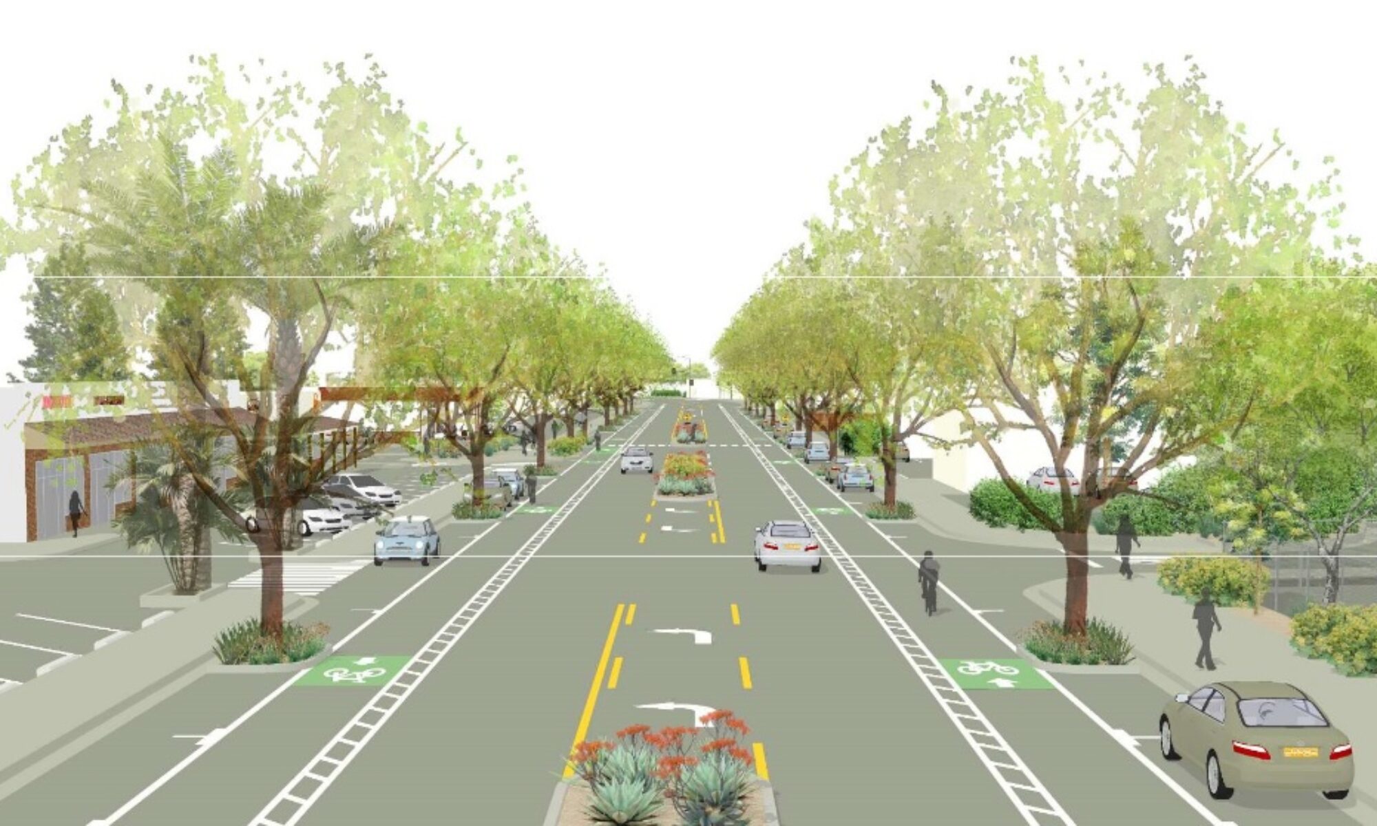
The second village area assessed was Oak View. Oak View has a larger commercial footprint than Casitas Springs and shows some effects of suburbanization with some buildings set back from the street and a wider section of Highway 33. The recommendations for this village include:▪ Streetscape improvements including possible lane reductions (five to three),landscape, bike, and pedestrian improvements focused from Larmier Avenue to Oak View Road
Gateway design considerations at Larmier Ave and Oak View Road, which may include features such as signage and landscaping. The most substantial transportation recommendation included here is the reduction from five lanes to three. The daily traffic volumes of around 20,000 vehicles per day are within the range of volumes that are commonly considered for three-lane cross-sections. (The Road Diet Informational Guide notes that road diets have been applied to streets exhibiting volumes up to 25,000 ADT.) Many communities have found that with such conversions, the right-of-way can be reallocated for other uses, such as bicycle lanes or pedestrian facilities. Further, lane reductions reduce speeds by eliminating fast lanes and driver weaving. Often such projects result in greater lateral separation between pedestrian and vehicle traffic, which may make walking more comfortable. This increased walkability can also foster economic development, as it creates a destination where residents and visitors can comfortably travel between destinations.
Road diets also clearly influence crash reduction. Converting a four- or five-lane street to a three-lane street reduces the conflicting streams of traffic and has been shown to reduce the number of collisions in most every case of implementation. Additional concerns are often raised due to necessary access by emergency vehicles. Typically designs gain support from local emergency responders prior to implementation, and features such as curbs that accommodate wider vehicle use are incorporated. It is anticipated that the roadway design will maintain 20’ of navigable space from curb to median to accommodate emergency vehicles. Features such as rounded curbs may be considered to facilitate use by larger emergency vehicles.
In the case of Oak View, the space gained via the lane reduction could be used to accommodate elements such as bike lanes and on-street parking.